CRREL Permafrost Tunnel Digital Twin
Web3D applications for infrastructure visualization and Arctic research
A multimodal digital twin of the U.S. Army Corps of Engineers Permafrost Tunnel, combining LiDAR, photogrammetry, and Matterport data to model thaw features and Arctic infrastructure risk. Presented at ACM Web3D 2025.
About the Project
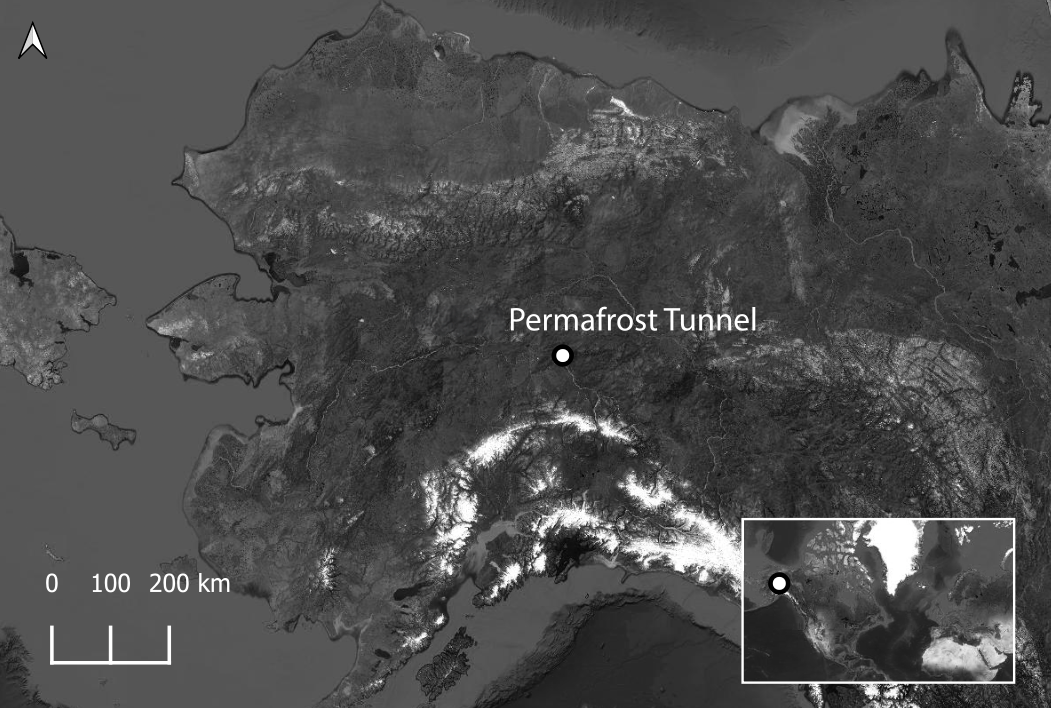
Permafrost thaw threatens Arctic infrastructure, cultural heritage, and climate stability. The CRREL Permafrost Tunnel outside Fairbanks, Alaska provides a rare opportunity to directly observe frozen ground, thaw features, and tens of thousands of years of climate history.
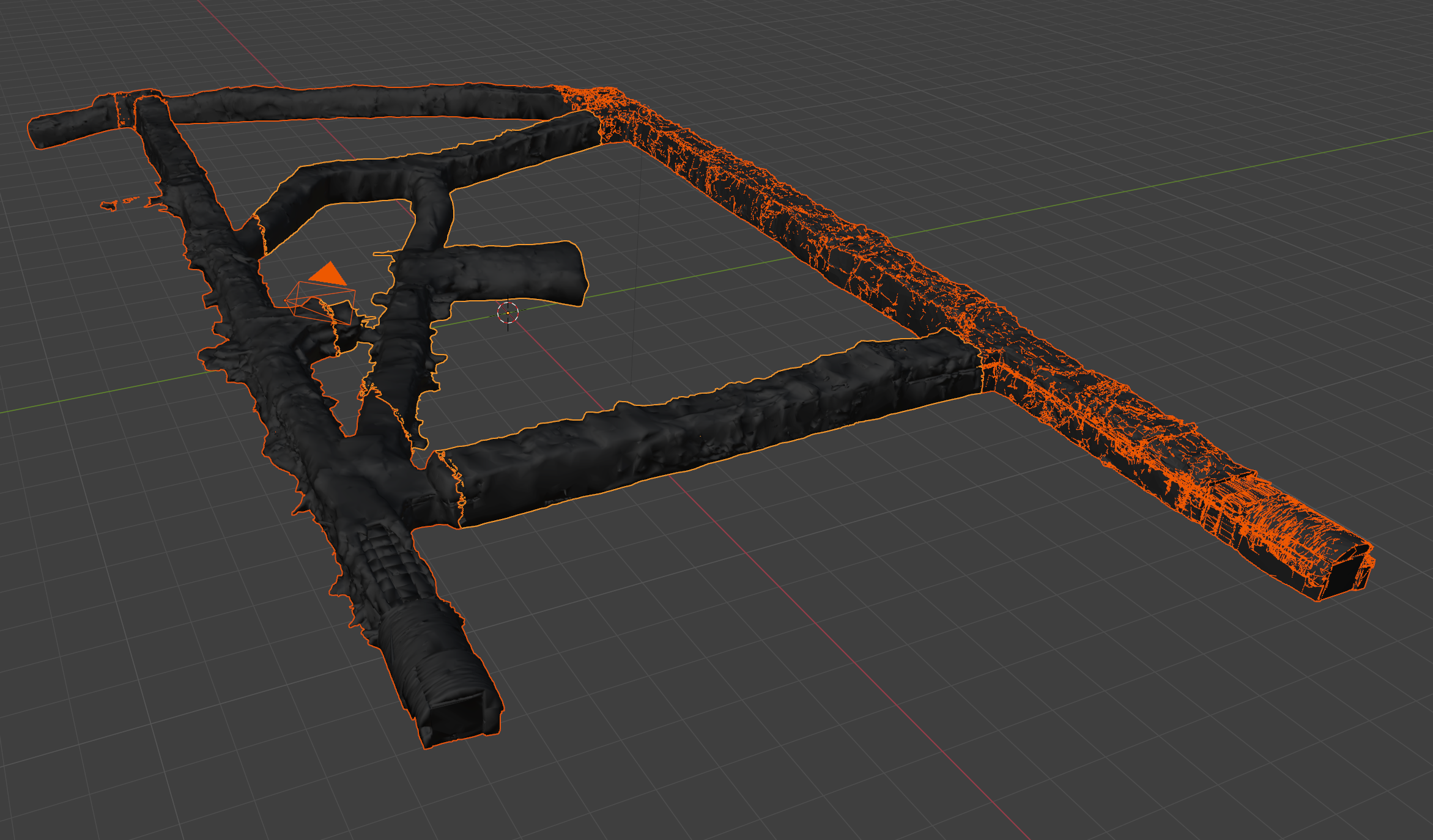
This project creates a digital twin of the tunnel using LiDAR scanning, photogrammetry, Matterport data, and Web3D deployment methods. The goal is to preserve, document, and visualize thaw processes in a format that is accessible to researchers, engineers, and the public far beyond the physical tunnel.
This work is part of the Defense Resiliency Platform (DRP), a multi-institution Arctic research collaboration focused on monitoring permafrost-related infrastructure risk.
Data Collection
Data for the digital twin was gathered using:
Terrestrial LiDAR scanning
Photogrammetry
Matterport Pro3 imaging
Supplemental 360° photography and video
Fieldwork inside the tunnel involved managing sub-freezing temperatures, limited power availability, and extremely tight underground spaces. Combining multiple sensing methods allowed us to build a richer, more accurate multimodal record of the tunnel’s structure and ice features.

Workflow & Pipeline
The workflow involved:
Cleaning and segmenting the large Matterport mesh into manageable sections
Chunking the tunnel model for smooth navigation and LOD-based performance
Performing aggressive decimation while preserving scientific fidelity, especially visible stratigraphy and thaw features
Correcting UV overlaps and repairing missing baked data
Baking hundreds of texture tiles into consolidated atlases (a process complicated by repeated Blender crashes)
Reassembling optimized segments using Inline and LOD nodes
Exporting the final assets through the Web3D X3D/VRML2 Blender exporter
These steps formed the backbone of the digital twin pipeline, balancing technical constraints with the need for accuracy. The result is a streamlined dataset that supports interactive exploration in the browser while maintaining the geological detail critical for permafrost research.
Publication
The CRREL Permafrost Tunnel Digital Twin: Web3D Applications for Infrastructure Visualization and Arctic Research.
Presented at ACM Web3D 2025 in Siena, Italy.
Acknowledgements
This work was created in collaboration with Olaf Kuhlke, Steven Rowell, Aaron Bergstrom, and partners across UND, UMD, NCEAS, and VT, with support from ERDC–CRREL and the Defense Resiliency Platform.
For full funding details, see the published paper.